WILDFIRES THREATEN THE COLORADO WE LOVE
Wildfires can impact everything we hold dear, threatening our families, our homes, and our way of life.
We’re all in this together and you’re part of the solution.

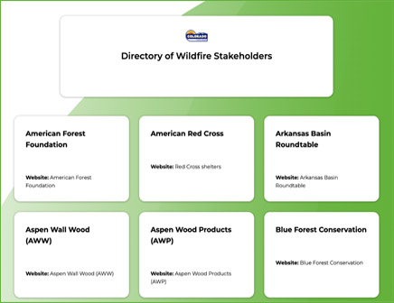
WILDFIRE THOUGHT LEADERS
LEARN MORE
These resources have been sourced from both local and global perspectives to help provide the most accurate information and increase awareness about wildfires.
Tips:
• Not all smoke is a danger sign. Check to see if there’s a prescribed fire in your area.
• Keep your cell phone charged when wildfires could be in your area.
• Purchase backup charging devices to power electronics.
• Create a “go bag” ready with essentials such as food, water, valuables and first aid supplies.
• Learn how to create a “clean room” at home.
• The Colorado State Forest Service produces a free newsletter to inform the public about its various programs.
Sign up here.
Tools:
• The Colorado Forest Atlas provides the best available wildfire info.
• Learn how to Live Wildfire Ready with the Colorado State Forest Service.
• Download the FEMA app for a list of open shelters during an active disaster.
• Create a Fire
Adapted Community document tailored to your community.
• Smoke and Fire Locator Maps, and Live Prescribed Fire Map InciWeb
• Dial 2-1-1 to find
vital services such as
emergency shelter, food and more.
FAQ:
• What areas are more prone to wildfires?
• How do I find out my
evacuation routes?
• Do I have adequate insurance coverage for my home and belongings?
• When are wildfires
most likely to occur?
• How do I get in touch with my local legislators to share my feedback?
• Federal, state and local
agencies: Which is responsible for what actions?
Innovations:
• Drones are helping fight wildfires.
• NASA satellite
instruments are often the first to detect
wildfires.
• Real-time Intelligence tools are helping firefighters track burn risks.
• Find more new
innovations at
Springwise.
• Dryad provides ultra-early forest fire detection as well as health and growth monitoring solutions for public and private forests.
LEARN MORE
These resources have been sourced from both local and global perspectives to help provide the most accurate information and increase awareness about wildfires.
Tips:
• Not all smoke is a danger sign. Check to see if there’s a prescribed fire in your area.
• Keep your cell phone charged when wildfires could be in your area.
• Purchase backup charging devices to power electronics.
• Create a “go bag” ready with essentials such as food, water, valuables and first aid supplies.
• Learn how to create a “clean room” at home.
• The Colorado State Forest Service produces a free newsletter to inform the public about its various programs.
Sign up here.
Tools:
• The Colorado Forest Atlas provides the best available wildfire info.
• Learn how to Live Wildfire Ready with the Colorado State Forest Service.
• Download the FEMA app for a list of open shelters during an active disaster.
• Create a Fire Adapted Community document tailored to your community.
• Smoke and Fire Locator Maps, and Live Prescribed Fire Map InciWeb
• Dial 2-1-1 to find vital services such as emergency shelter, food and more.
FAQ:
• What areas are more prone to wildfires?
• How do I find out my
evacuation routes?
• Do I have adequate insurance coverage for my home and belongings?
• When are wildfires
most likely to occur?
• How do I get in touch with my local legislators to share my feedback?
• Federal, state and local
agencies: Which is responsible for what actions?
Innovations:
• Drones are helping fight wildfires.
• NASA satellite instruments are often the first to detect wildfires.
• Real-time Intelligence tools are helping firefighters track burn risks.
• Find more new innovations at
Springwise.
• Dryad provides ultra-early forest fire detection as well as health and growth monitoring solutions for public and private forests.
LEARN MORE
These resources have been sourced from both local and global perspectives to help provide the most accurate information and increase awareness about wildfires.
Tips:
• Not all smoke is a danger sign. Check to see if there’s a prescribed fire in your area.
• Keep your cell phone charged when wildfires could be in your area.
• Purchase backup charging devices to power electronics.
• Create a “go bag” ready with essentials such as food, water, valuables and first aid supplies.
• Learn how to create a “clean room” at home.
• The Colorado State Forest Service produces a free newsletters to inform the public about its various programs.
Sign up here.
Tools:
• The Colorado Forest Atlas provides the best available wildfire info.
• Learn how to Live Wildfire Ready with the Colorado State Forest Service.
• Download the FEMA app for a list of open shelters during an active disaster.
• Create a Fire Adapted Community document tailored to your community.
• Smoke and Fire Locator Maps, and Live Prescribed Fire Map InciWeb
• Dial 2-1-1 to find vital services such as emergency shelter, food and more.
FAQ:
• What areas are more prone to wildfires?
• How do I find out my
evacuation routes?
• Do I have adequate insurance coverage for my home and belongings?
• When are wildfires
most likely to occur?
• How do I get in touch with my local legislators to share my feedback?
• Federal, state and local
agencies: Which is responsible for what actions?
Innovations:
• Drones are helping fight wildfires.
• NASA satellite instruments are often the first to detect wildfires.
• Real-time Intelligence tools are helping firefighters track burn risks.
• Find more new innovations at Springwise.
• Dryad provides ultra-early forest fire detection as well as health and growth monitoring solutions for public and private forests.
FEATURED HIGH-RISK WILDFIRE PROFILES
Some areas are a higher wildfire risk for various reasons, including their proximity to
the forest and available evacuation routes. Click here to see the risk to your area.
Some areas are a higher wildfire risk for various reasons, including their proximity to the forest and available evacuation routes. Click here to see the risk to your area.
